End Of Trail – Mapping Section 8 – Feb. 27, 2012
Four hardy Traildogs today participated in the layout and flagging of the final section of the trail. Starting at where the trail will cross Spillway Rd., we threaded our way through the narrow gap of public land between the lease land of the Spillway Resort, now called “Echo Canyon Resort and Marina“, and a plot of private land to the south.

Planning LOViT Section 8's route from Spillway Road to Blakely Dam
Our team was able to find the property corners of the private land which served as the south boundary of our layout. We flagged the trail about a 100 yards north of the private land and well outside the boundary of the Echo Canyon Resort lease land.
Once we passed through this gap we took the trail along a ridge that led to the new road leading up to the Corp of Engineers new administration building located atop the mountain on the west side of the dam. We located a safe crossing point on this road and then marked a loop around the top of the mountain to the west of the dam.
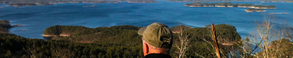
The view of the Dam and the valley to the south along the Ouachita River from the end point is all we imagined it would be.

The Alpha Dog at the End of the Trail!!!
This new route will need to be reviewed by both the US Forest Service and the US Army Corp of Engineers. Following these approvals, we can proceed with the various assessments that are required before we can begin the final construction phase.
Jerry