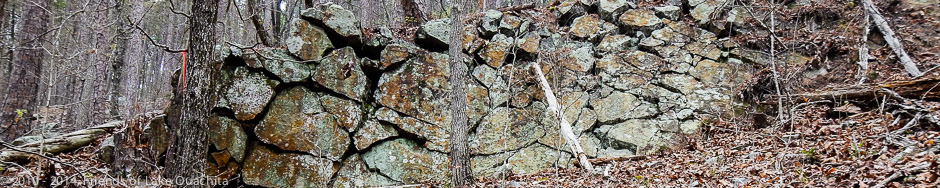
We hope you enjoy your time visiting our website, and that you have a wonderful and safe experience along the Lake Ouachita Vista Trail and the beautiful area through which it runs.
The posts on this "Home" page let you know what's happening on and around the Trail. The rest of the pages on the site introduce you to the Trail segments, the history of the LOViT and of Lake Ouachita, and to the "Traildogs", volunteers who maintain the existing trails and work with the US Forest Service, the US Army Corps of Engineers, and others to create new trail segments. We also include maps of the trails (this is always a work in progress), and we provide information about amenities and places to stay in the area.
Please consider a tax-deductible donation to Friends of Lake Ouachita in support of the Lake Ouachita Vista Trail. Thank you!
The Trail especially needs your help now because of the failure of the Elevated Walkway over Gap Creek and Lake Ouachita.
The Lake Ouachita Vista Trail traverses U.S. Forest lands that have long been popular hunting grounds in all seasons. All Trail users should be aware of these activities and not wear clothing that could be mistaken for wildlife. Bright colors and hunter orange eliminate most instances of mistaken identity. See this Arkansas Game and Fish "Hunting Seasons" link for more information.
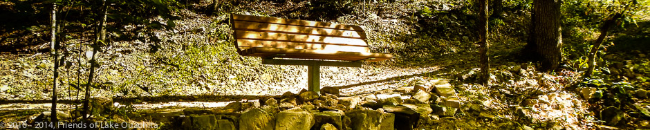
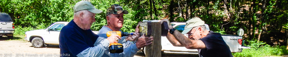
Wednesday’s weather provided a perfect day to be out on the Trail again. We had five Traildog volunteers gather today at the Brady Mountain Road Trailhead parking area to assist with the installation of two new benches along LOViT’s Section 8, which runs from Brady Mountain Road to its easternmost trailhead at the Avery Recreation Area below Blakely Mountain Dam. Before starting the bench installation, we worked on flagging a spur from the parking area over to the Trail some 100 feet away. There currently is no connector from the Trailhead parking to the Trail; users must hike or bike down the busy Brady Mountain roadway to enter the Trail. Is is our plan to construct this short spur to limit having to utilize the busy roadway. Today, we loaded up the bench frames and slates with their hardware, along with 80 lb. bags of concrete and gallon bottles of …Click to read the full article
Four years of storms and neglect were remedied last Friday when six Traildogs spent the day improving Section 5 of the Trail where it parallels and crisscrosses US Forest Service Road 47 between Crystal Springs Road and Hickory Nut Mountain Road. We worked the part of this section from the FS47A trailhead at the eastern base of Hickory Nut Mountain to Pipe Spring, where the LOViT joins the Charlton Trail leading to the Crystal Springs Campground Pavilion. We sought to improve access and signage at each entrance and exit point along the road. We started at the intersection of FS47 and FS47A, where we installed an assurance directional sign post. The post directs users to follow FS47A 1/4 of mile north to where the Trail turns left and proceeds west to the summit of Hickory Nut Mountain. We also installed a new sign at the FS47A trailhead. We cleared all …Click to read the full article
On Tuesday, May 6, the Traildogs returned to the Trail, this time to install a trail bench along the ADA section of the Trail. We had four Traildogs helping install the bench at the junction where the ADA branches off the loop toward the elevated Trail.
With the final 700 feet or so of Section 8 of the Lake Ouachita Vista Trail (LOViT) completed, we mark today as the day on which the original plan for the Trail has been fulfilled! Twelve years ago, Jerry Shields and Al Gathright began an effort to create a hiking and biking trail along the southern shore of Lake Ouachita with the intent not only to provide a terrific experience for those who enjoy this beautiful part of the country in which we live, but also to provide an additional tourist attraction to the area that would help bring “shoulder season” traffic to the resorts, restaurants, crystal shops, and other businesses in our area. Their goal has been realized with today’s completion of the LOViT as the Traildogs groomed the final stretch that emerged at the Trail’s easternmost trailhead near the Avery recreation area below Blakely Mountain Dam. A great …Click to read the full article
A warm and humid day on the Trail today, but it didn’t slow down the seasoned Traildogs as we pushed the finish work further down the south flank of Blakely Mountain. We completed finish work on the old tramway roadbed and down across the spring-fed creek at the bottom of the mountain. We spent a couple of hours armoring the very wet and muddy crossing of the creek as we began our approach up to the Corps’ security gate at the intersection of Rick’s Road and Blakely Dam Road. We visited with the Progressive Trail Design Crew, who assured us they would complete the machine finish work to the Avery Recreation Area today. We are scheduling our next and hopefully final workdays next week. We are planning three scheduled workdays: Monday April 7th, Wednesday April 9, Friday April 11th, and, if necessary, Saturday, April 12th. Once we determine our final …Click to read the full article
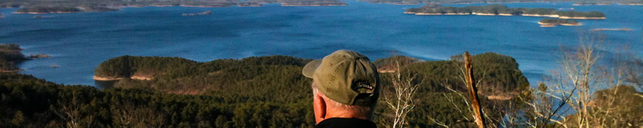
Spring and pollen are back as we began our descent of Blakely Mountain from the switchbacks leading down from the Blakely Mountain Dam vista site. Without the Trail, very few people have ever seen the view from this vista that overlooks the Dam and the bay leading up to the face of the dam. It is an area of large boulders that nature has taken time to paint with grey lichens and emerald moss. A group of eager Ouachita Mountain Hikers came through our work site this morning, checking out the new trail from the security gate on Rick’s Road over to the Brady Mountain Road Trailhead. We could also see fresh mountain bike tread marks in the freshly turned soil on the trail. Seems everyone is ready to enjoy this new section! We had another crew of experienced trail groomers today, and we pushed the finished tread about halfway …Click to read the full article
The prescribed burn took place on Monday, March 31, on very short notice. We did get a note out via Facebook, but we didn’t get notified in time to get a website update out ahead of the event. The USFS was very careful with respect to placing notices at the trailheads, and they covered the length of the Trail to make sure nobody was on Little Bear or Bear Mountains at the time of the burn. The United States Forest Service (USFS) is planning a prescribed burn on both Bear Mountain and Little Bear Mountain in early April, 2014. The burn will cover some 5500+ acres from Crystal Springs to Brady Mountain. The Forest Service will post signs warning potential hikers of the event, and it is most important that you do not enter this area prior to the prescribed burn event. The prescribed burn will take place on a …Click to read the full article
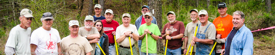
The last day of March proved to be a winner for trail diggers. We had a great team of experienced Traildogs meet at the Blakely Mountain section of the trail just east of where the trail crosses Rick’s Road. The Progressive Trail Design (PTD) team had roughed in and machine groomed the trail last week, and it was ready after two sunny days for the final hand grooming that only the Traildogs give to a a trail’s surface. We started the day developing the trail crossing sites on both the west and east sides of Ricks Road by constructing four large rock cairns on each side of the entry points and installing trail user posts on both sides of the road. We then broke into two team working the trail surface and a special effort on the angle of repose to remove all the loose rocks that might later roll …Click to read the full article
Saturday was a day to remember on the Blakely Mountain section of the Trail, with a gang of Little Rock Air Force Base Volunteers joining the Traildogs for a day of finish work on the newly constructed tread progressing east across the rocky southern face of Blakely Mountain. The Progressive Trail Design Machine Crew worked through the boulder strewn slope, with the trailing two machines reaching the Rick’s Road crossing, and the lead Sutter Trail Machine reaching the Dam overlook area. The rain showers that crossed the area Friday night made conditions less than ideal for finish work, but the volunteers persevered and pushed the finish work up to the Rick’s Rd. crossing, catching the two trailing machines by day’s end. The day was highlighted by the addition of the Arkansas Wildlife Federation’s First Cook, Wayne Shewmake, joining the volunteers, and while the trail volunteers were busy with trail work, …Click to read the full article
Another good day on section eight. The Traildogs pushed the trail further along the east slope of Brady Mountain, with grooming now only 1/10 of mile from the Forest Service road that leads down the mountain. While a team of 4 Traildogs (Al, Chuck, John, Mike) pushed down the mountain, Traildogs Robert and Dan started from Brady Mountain Road and painted blazes along the trail, catching up with the rest of the team just in time for lunch! Well planned! The new tread is now marked all the way to where the Trail joins the Forest Service road that comes out on Spillway Road. We will not have a scheduled workday on Wednesday, March 12, but will return to the trail on Thursday at 9:00 am. We will continue to meet at the parking area on Spillway Road. The Progressive Trail Design Team is now pushing the trail east of …Click to read the full article